1
/
of
1
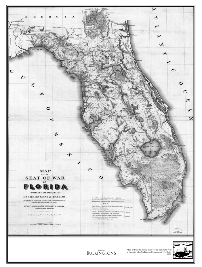
Second Seminole War 1839 Florida Map, by US Topographical Engineers Lt. J.E. Blake and Captain John MacKay, 18x24, Hahnemühle Print
Second Seminole War 1839 Florida Map, by US Topographical Engineers Lt. J.E. Blake and Captain John MacKay, 18x24, Hahnemühle Print
Regular price
$45.00 USD
Regular price
$65.00 USD
Sale price
$45.00 USD
Unit price
/
per
Couldn't load pickup availability
This map was made in 1839, by Captain John Mackay and Lieutenant J.E. Blake, U.S. Topographical Engineers under the command of Brigadier General Zachary Taylor, who would later become the 12th President of the United States.
It's a map of the whole state of Florida during the Second Seminole War, which lasted from 1835 to 1842. It's very detailed and depicts Florida before any large-scale settlement was made. It features in the book we republished War in Florida available here: https://amzn.to/4qcOSQ5
Printed on Hahnemühle Photo Rag, 45x60 cm / 18x24" a high quality German paper ideal for detailed prints.
Share